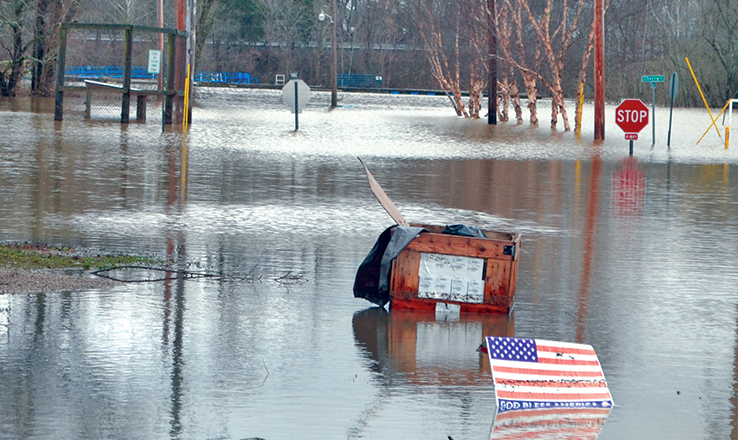
By Wayne Gates –
The National Weather Service is predicting that the Ohio River will remain above flood stage for the next 30 days.
If the rainfall leans to the high side of estimates in the Ohio River Valley, flooding could approach or exceed levels not seen since 1997.
“They are predicting that the Ohio River could be in the mid sixties during the first week of March. That would cause significant flooding in the river communities. Here in Brown County, that would put us at or above the level of the 1997 flood. Back then it was 62.5 feet here,” said Brown County Emergency Management Coordinator Barbara Davis.
“If we get to 64 feet or higher, we will get to the point where we will have to open up a shelter. We projecting two to five inches of rain in our area over the next several days in our area, with some places expecting even more.”
Davis said that residents should turn to their local officials for guidance over the next couple of weeks.
“Nobody knows better how much the river is going to flood than the people who live there and the elected officials that are responsible for that area. They know at what level people need to evacuate,” she said.
Davis said that she is in the process of planning a response to the flooding.
“I will be putting together a group to share information that will probably meet next week. It will bring in partners like the county commissioners, the county engineer, the Ohio Department of Transportation, the sheriff’s department and others.”
The National Weather Service tracks the Ohio River online at www.weather.gov/ohrfc/
Users can click on the gauge location closest to them and see what the NWS expects flood levels to be. The further out the data is, the more likely it can vary.
For Maysville at 64 feet the NWS writes; “Significant flooding occurs with about half of Ripley, Augusta, Higginsport and Aberdeen flooded.”
At 60 feet the expected result is; “Significant flooding occurs in portions of Manchester, Ripley and Aberdeen, Ohio. Water enters homes and businesses in these communities, mainly structures between Route 52 and the river, as well as any structures close to streams, which will incur major backwater flooding.”
At 58 feet, the NWS predicts; “Moderate flooding occurs along the river especially on the Ohio side in Adams and Brown Counties. Stretches of Route 52 are flooded, and backwater flooding closes portions of Route 221 and other secondary roads along creeks. Some homes and businesses between Route 52 and the river are flooded.”
Davis said that people need to follow the Maysville and Meldahl Dam gauges rather than the Cincinnati ones.
“The river narrows as it gets closer to Cincinnati and the river levels are typically six or seven feet higher than they are in Brown County. I want to make sure that people know that, so when they hear a higher number on TV, they don’t think we are putting out bad information,” Davis said.
“It’s personal responsibility to be aware of how flooding will affect where you live. If people are not aware of what flood level will affect their home or the road that would prevent them from leaving, they need to ask their local officials.”
And if the river does rise above sixty feet? Davis said be ready.
“Don’t wait until the last minute to get your stuff moved out or onto higher ground. Don’t wait to get your family out of there. If they have physical limitations, they need to reach out to emergency responders early to ask for help,” she said.
“Make sure you have plenty of provisions on hand in case you get stuck or plan to stay home. I would encourage people to look at the FEMA website ready.gov for tips to take care of themselves.”
Davis also asks that citizens make an effort to stay informed.
“Be aware and be able to get local alerts, either through the media or with a NOAA weather radio. If it becomes necessary, we will issue an alert on what an evacuation route should be. People just need to be aware and start preparing, because chances are likely some of our citizens will have to relocate for a while.”

